-->

Tuesday, August 11, 2020

A Glimpse of Glacier National Park


I stood there in awe ... just trying to take it all in. As we walked from our campsite to the shoreline of Lake McDonald, the endless beauty of Glacier National Park lie before us.
Patches of snow still on the mountains ...
Deep blue water flowing on for miles ...
Cascading hillsides of green pine trees ...
From near our campsite at Fish Creek, I was getting my first glimpse of Glacier National Park.
Doug was first captivated by Glacier's beauty nine years ago when he did a bike tour around the park with a few of his biking buddies. From the moment he got back home, his only traveling ''bucket list'' item was to take me there for more camping and hiking. Earlier this year, we decided that Glacier would be our main travel destination for this summer. With the arrival of Covid, however, we were a little unsure if this trip would be possible. The eastern border of Glacier lies next to the Blackfeet Indian Reservation, so entrances and services on that half of the park are currently closed due to the pandemic. Only one of the seven campgrounds in Glacier is open, limiting our options for camping in the park. But, as luck would have it, we were able to snag a spot for four nights in Glacier's Fish Creek Campground ... And so, we got ready for a ...


Glimpse of Glacier National Park!

When we arrived at the park, we quickly settled into our campsite and scoped out the area around us. We started on the trail near our campsite that led us along the shore of Lake McDonald. I got a little nervous when the path took us farther into the woods since we had no bear spray, and I was sure that Doug would be able to out run me if necessary! Doug just rolled his eyes slightly as we turned back, and probably muttered to himself how highly unlikely it would be that we would be lucky enough to even catch a glimpse of a grizzly.
Like many first time tourists, we were eager to see it all. Since Going to the Sun Road is the only road accessible for anyone visiting the park right now, it was the one we needed to take in order to access any of the open hiking trails. There is, however, a vehicle length restriction of 21 feet for this road which is exactly what the Baby Beest measures. We had our fingers crossed that the park rangers wouldn't stop us for being too long because ... We were ''Going to the Sun''!

If that deer isn't concerned
about the steep drop off at the
side of road, Baby Beest isn't
going to be concerned either!

The Going to the Sun Road starts out fairly flat as it runs along the Lake McDonald shoreline. The Avalanche Creek area is the point at which the road starts its famous twists and turns and begins to gain some serious elevation. I am happy to say that we made it up to Logan Pass which is the location of the Highline Trailhead, the one trail that Doug had his heart set on hiking.


But alas, we found out once we got there that we are going to have to settle for a glimpse of the Highline Trail. In late July it was still closed to hiking since there was still snow on the trail. I suppose that I should be disappointed, but when Doug pointed out that the trail runs alongside the mountain ridge on the right side of this picture below, I was secretly happy to save that RVenture for another time!


We did try our snow climbing skills on the Hidden Lake Overlook trail that starts out behind the Logan Pass Visitor Center. This was challenging enough for me, so I am glad that I didn't have to use these snow climbing skills on a higher, narrower trail like the Highline. There were also a lot of people out on this wide trail, so we are both thinking that social distancing would get to be a bit more difficult as the trail narrows.
On the way back down, we found a scenic parking spot on the side of the road. 


I will cook dinner any time when the view out of my kitchen window looks like this!


We watched the sun disappear behind a distant mountaintops and quickly started back down in order to stay well ahead of the hundreds of other sunset spectators. 


While it is only 32 miles from our campground to Logan's Pass, it took us almost an hour and fifteen minutes to make the trip each way. Since our hiking options were somewhat limited up there with the snow and road closures, we decided to get a glimpse of the trails closer to our campsite.

Howe Lake Trail
Getting there is half the fun! We were told to ''just follow this gravel road up about six miles to the trailhead'' ... the ranger forgot to add the fact that this road was a bit rough, steep, narrow and twisty at times! Doug kept Baby Beest on the road while I prayed that we wouldn't meet another big vehicle like ours going the opposite direction.


Once we got there, it was a delightful 1.6 miles hike through a forest of wildflowers to a serene mountain lake.


 Rocky Point Trail
Our favorite ''let's take a hike'' hike. We started out from our campsite and followed a loop through the forest and out to Rocky Point. On the way back the trail followed the lakeshore back to the camping area. Gorgeous lake and mountain views everywhere we looked!


McDonald Creek Trail
In order to find a parking spot, it is best to plan to arrive at the trailheads either early in the morning or around supper time. So one morning we decided to get up with the sun, drive to the trail head parking area, and enjoy our coffee overlooking McDonald Creek. We then hiked along the river and through beautiful pine forests until we got to the waterfall at the end of the trail. Doug was unsuccessful in his search for moose that we were told frequented this area, but it was nice to have a beautiful 8+ mile hike done and be back lounging in our hammock by 11 am.


Avalanche Lake Trail
This is a very popular trail, and even more so this year with so much of the park closed off. I knew that I would be pushing my luck to get Doug up early two days in a row, so we tried the late evening time frame for this hike. We arrived at the trail head around 5 pm and luckily snagged a spot that didn't leave Baby Beest's back end hanging out in the road. After eating dinner (during which time the area seemed to empty out more), we started our 2.3 mile out and back hike. There still were plenty of people on the trail, but for the most part, the trail was wide, so we didn't have to don our lovely masks very often. The path started out along a massive river gorge and led us through a pine forest where the evidence of avalanches dragging down huge pine trees was definitely visible.


There were rumors of a bear sighting as we approached the lake, but we were OK to have missed him and just enjoy the sheer beauty of Avalanche Lake and its distant waterfalls. 


During our four days there, we experienced just a glimpse of Glacier National Park. But that is alright. A place as beautiful as Glacier is best enjoyed in small doses of ...

... wildflowers overlooking a mountain lake,

... pine trees towering above,

... wildflowers carpeting the
mountainsides,
... curious friends greeting us,

... and wild huckleberries just begging
to be picked.


Glacier National Park is a place so magical, that even
this small glimpse
has created memories that will be forever etched in our hearts.


Sunday, August 9, 2020

The Beautiful Badlands of Montana: Makoshika State Park

Just when we realized that both North and South Dakota get credit for spectacular Badlands ... we discovered a third state with ''Badland Bragging Rights''. While it may be on a smaller scale, western Montana can boast of equally spectacular Badland scenery that is found in its Makoshika State Park. 

In the past few weeks since we started traveling west, my Google news feed has seemed to know what I need to know even before I know what I need to know. (Did you follow that??) Articles on the best campgrounds, hikes, and state parks pop up all the time. Because we are intrigued with the unique outdoor scenery and experiences that can be found in many state parks, I tend to pay attention to the ''Best State Parks'' lists. And that is how Makoshika State Park came to our attention.
Located an hour west of Theodore Roosevelt National Park, we decided to stop and check it out after boondocking at a Harvest Host brewery nearby the night before. The main campground was booked, but the ranger did say that if we wanted to drive up a fairly steep road, she though that we could get one of the primitive (meaning no water or electric hookups) first come/first serve campsites. This, once again, is the beauty of Baby Beest. She and her driver like the challenge of steep roads, and she doesn't (usually) need any hook ups since her batteries get charged while driving.
On the way up we stopped at Cap Rock Trailhead for a first glimpse at the amazing rock formations. The trail led us up, down and around all sorts of unique structures that appeared to be right out of The Flintstones television show ... complete with a the stone bridge to get from one house to the next. After our hike, we reached Pine On Rocks Primitive Campground, and as Fred would say ... ''Yabba Dabba Do!!''
We found one of our most FAVORITE CAMPSITES EVER!!!
Located on a point overlooking both sides of the canyon, we had spectacular views all around us. We are both thinking that we could have said that we were at the Grand Canyon and people would have believed us. 


That afternoon we took another hike on one of the many trails that surrounded us. 
Once again, rock bridges led us across, down and back up again.

For someone who very rarely sits still, a campsite gets true high marks from me if it calls me to just hang out in my hammock, enjoy the smell of the pine trees, listen to the birds, rock in the gentle breeze, and just enjoy the scenery. It also helps if it has a good cell signal ;-)

We struck up a conversation with the campers next to us. Craig caught our attention as he was scurrying down and back up the hillside with a very large camera and tripod in tow. He is a talented landscape photographer, and we enjoyed hearing about all the beautiful areas that he has photographed. Hearing him describe the beauty of Glacier made us even more excited about our next stop. As I was lying in my hammock, I heard a drone flying over, and shortly after, got notice of a new email. Craig had taken an amazing overhead photo of our most FAVORITE CAMPSITE EVER!!!
Seeing the landscape from that prospective will always help us remember this magical site! You can enjoy even more of his talent by visiting his website ScenicTraveling.com.

Later that evening, I found a prime seat for sunset over the beautiful Badlands of Montana. Although Makoshika State Park may not be easy to pronounce, I am sure happy that I paid attention to that ''Best of'' article that named this the best state park in Montana.
Finding hidden gems like Makoshika State Park continue to fill us with more desire to seek out all the big or small ''new-to-us'' places where God's beauty abounds. 

And seek it out we will ...
... as we ''enjoy'' our final eight hours of driving to the crown jewel of national parks ... Glacier!

Thursday, August 6, 2020

The Beautiful Badlands of North Dakota: Theodore Roosevelt National Park


If you can handle the miles and miles of flat farmland while driving across North Dakota, then this state will give you a beautiful surprise when you reach its western border. All of a sudden, the flat plains are transformed into the rugged beauty that is often referred to as the North Dakota Badlands.


It is a place where Theodore Roosevelt came in 1883 to hunt bison and to grieve following the death of his first wife. It is also a place that influenced him to turn his love of nature into law when as president, he helped create five national parks and millions of acres of protected land. Because of his conservation efforts, it is fitting that this beautiful North Dakota surprise is called Theodore Roosevelt National Park.


This national park consists of two separate areas. The larger South Unit is located just off of Interstate 94, and thus seems to attract the most visitors. The North Unit is about 70 miles north of I-94 and appears to be the quieter of the two. We were fortunate to be able to visit both areas. Here are my favorite views from ...

The North Unit,


and The South Unit

Which do you like best??

Because of the current pandemic, campgrounds in this national park are closed, but we found a forest service campground, the CCC Campground, conveniently located just outside the North Unit entrance. For $6 a night, there may be no frills, but the views that surrounded us certainly filled us with awe! 


For star-gazers like Doug, the total darkness at night was an added bonus as we was able to see Comet NEOWISE make an appearance in the northern night sky after a beautiful sunset. 


The North Unit is smaller and has a 28 mile (out and back) scenic drive. We drove to the end of the road at Oxbow Overlook and hiked out to Sperati Point for some amazing views of the rock formations that the Little Missouri River helped carve.


The next morning we packed up and decided to head back towards I-94 to check out the South Unit. Sure glad we did! The South Unit has a 36 mile Scenic Loop around the park, but unfortunately, a section was currently closed off, so once again we made an out and back drive. We still saw some amazing landscape, but it was a little slow going at times with more tourists and bison traffic jams! 


We make it to the Buck Hill trail head and hiked out to experience ... 


... how beautiful life is when you live on the edge!


One benefit that we are finding when we visit national parks in our van is that we don't have to think about packing food or water since we always have our kitchen with us. And especially now with limited services at many of the parks, we are loving being able to enjoy spectacular views right outside our door as we sit at our dining room table.


The park was definitely filling up with tourists after lunch, so we decided to head out as we had a Harvest Host brewery to check out later that evening. But first ... a little off-roading for the Baby Beest.


Doug had read about a Petrified Forest portion of the park that can be reached by hiking a 10 mile trail in the park or ... by doing a five mile drive on a road just outside of the park. This route takes you up a gravel road with a few steep climbs, but the park ranger assured us that it was in pretty good condition. Time to put Baby Beest to the test!


No problem for Baby Beest and her expert driver! From the trail head parking lot it was a one and a half mile scramble over some rocks and across a grassy meadow ... So worth the journey to see the scatterings of fossilized trees lying all around us!


As we left the park and crossed the Montana border, we realized that although the ride across North Dakota is long, the payoff is great. There is so much beauty in the Badlands of North Dakota ... and we are grateful that Theodore Roosevelt felt the same way 137 years ago! 


Sunday, August 2, 2020

The Bison Are BIG in North Dakota!


The unknowing eye may call this a buffalo. But to anyone who is from North Dakota, and especially those who proudly display this green and yellow flag ...


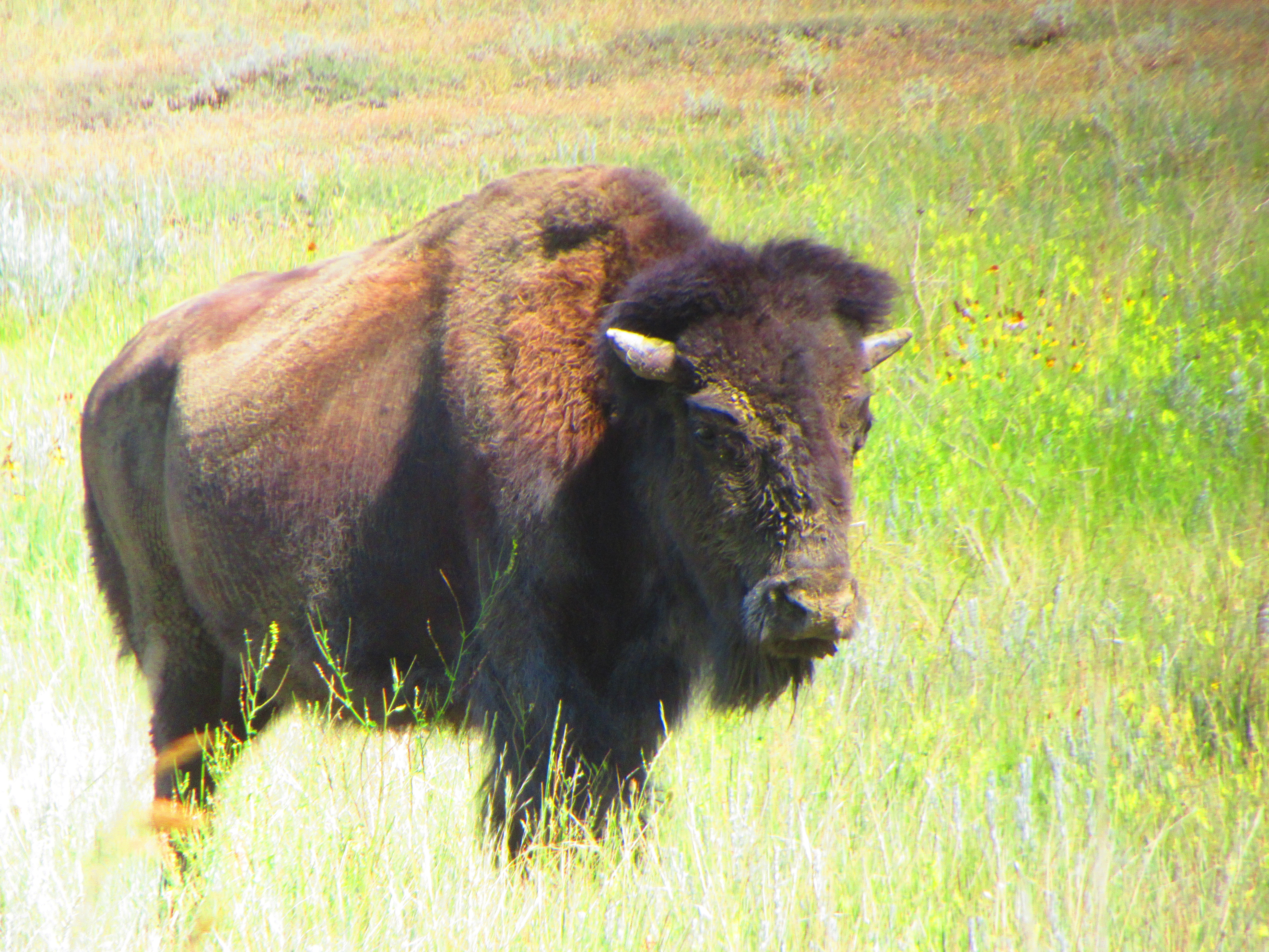
... these are Bisons. And as we crossed the Minnesota border and headed west, we quickly realized that the bison are BIG in North Dakota.


North Dakota is a new state for RVentures. When exploring a new area, I like to consult Roadside America to make sure that we take in all the quirky and unusual sites that are on our way. The app advised us to get off I-94 in Jamestown because ... who would want to miss the ''World's Largest Buffalo''??!!


''Dakota Thunder'' stands 26 feet tall and seems to invite weary travelers to stop and enjoy something just a little bit different from the seemingly endless fields of corn and wheat and cows. He got our attention!


Our first overnight in North Dakota was the capital city of Bismarck. There I was able to get a picture in front of my 19th state capitol building ...


... but as you can see by the empty square above, my photographer failed me! Not sure what happened to the picture that Doug took, but I guess we are just going to have to try it again sometime in the future.


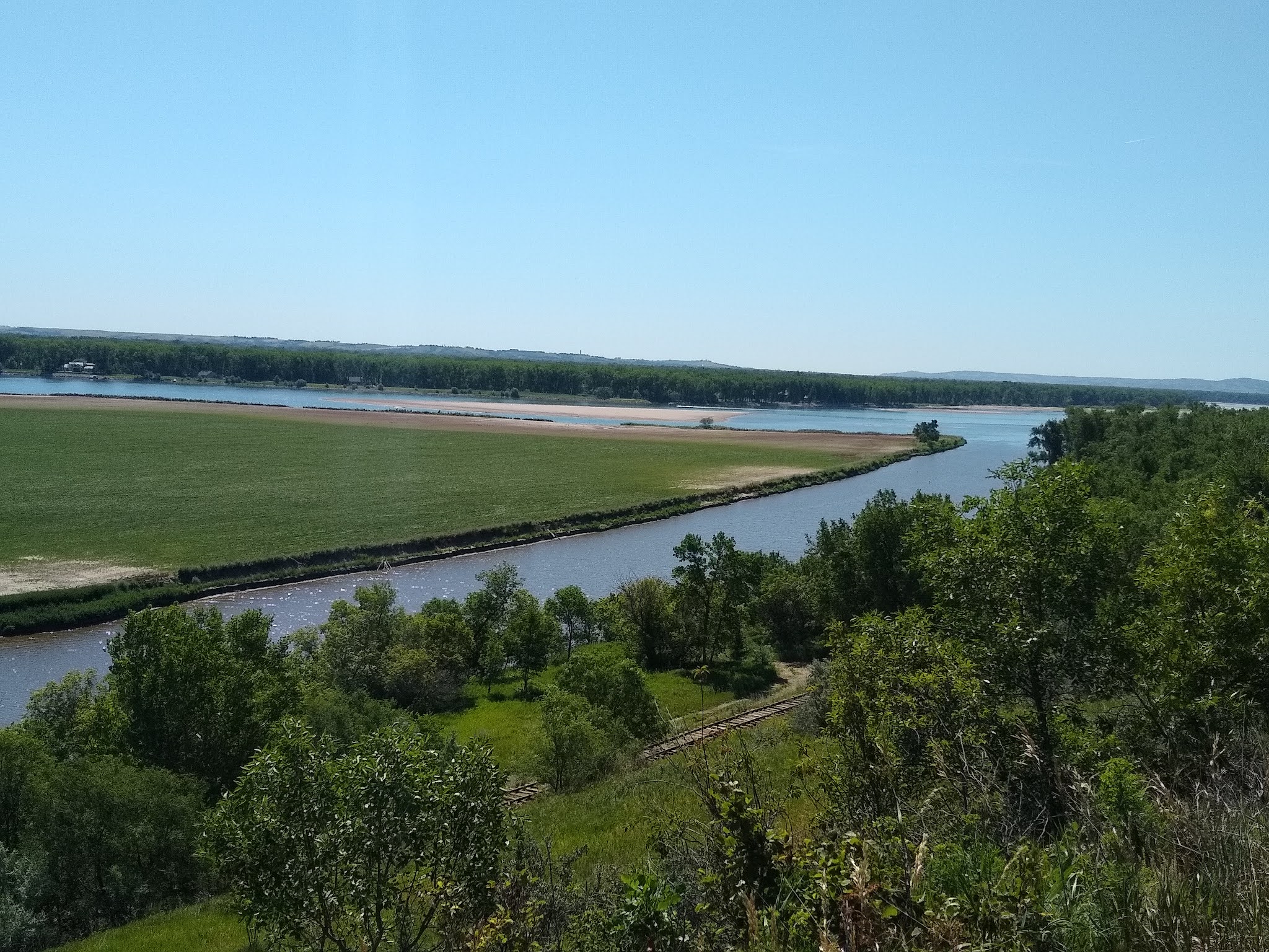
Just south of Bismarck, we stayed at a great state park. Fort Abraham Lincoln State Park sits on the banks overlooking the confluence of the Heart and Missouri Rivers. In addition to beautiful scenery and biking, the park celebrates its historical significance with some very interesting historical displays. On-A-Slant Indian Village is a reproduction of the Mandan earth lodges that stood on this land hundreds of years ago.  


Displays in each of the structures give a fascinating account of everyday Indian life on the northern prairies. Time and time again, the displays stressed how BIG the bison was for this Indian culture, as it provided food and materials to help sustain these early tribes.


Continuing our westward trek, we were once again drawn off the highway to admire another BIG North Dakota landmark ... ''Salem Sue''!


This giant Holstein cow stands 38 feet tall and was build by the town of New Salem, North Dakota to honor the local dairy farming industry. Continuing up the hill from ''Sue'', we had a great view of the endless fields of North Dakota agriculture.


After many hours of driving, these fields can seem quite mundane  ... but as we looked out over these endless fields, we were struck by their importance to Americans. These fields of wheat, corn, Holsteins, and (occasionally still) bison ... and the farmers that work the land, help feed America. And that is a BIG reason for us all to be proud of the land of the Bison!