-->

Saturday, August 15, 2020

Biking ''The Crown Jewel'' Route of the Hiawatha


A friend and fellow wanderer blogged a few weeks ago about riding ''The Crown Jewel'' of bike trails when they were in northern Idaho. This quickly grabbed Doug's attention. After some research, he happily announced that we would pass very close to this trail as we continue our way west. And even if it had been out of our way, who can pass up biking through scenery like this?


Not us! Come along as we take you on the
Route of the Hiawatha Bike Trail!

Located on the Montana-Idaho border, this 15 mile out and back trail is fairly close to Interstate 90. In fact, we got our tickets and boondocked for two nights in the parking lot of Lookout Pass Ski and Recreational area which was located on the I-90 Exit 0 just as we entered Idaho.


The Route of the Hiawatha is a 15 mile mostly downhill (about a 2% grade) ride on a former train bed that is another ''rails to trails'' beauty. This particular section starts near Taft, Montana and takes you through 10 tunnels and over 7 sky-high trestles. Most people do the downhill ride and take a shuttle bus from the end point in Pearson, Idaho back to the starting point. Trail passes are $13 and the shuttle bus return ride is an additional $12. During this time we don't get very excited about riding in a bus with lots of other people, so we didn't buy a shuttle bus ticket, as we hoped to accept the challenge of biking back up the trail. I hoped that I wouldn't regret that decision.


After picking up our trail passes at the ski office in the morning, we drove about seven miles on back roads to the trailhead. Equipped with our bike lights, we entered the first and longest tunnel that marks the start of the trail. There was definitely no ''light at the end of this tunnel'' for quite a while as it is 1.6 miles long. The squeals of delight from the young bikers that echoed off the tunnel walls added to the fun of this long, cool, damp tunnel.


After coming out of the first tunnel, I realized that this wasn't going to be an easy downhill coast. We were not biking over finely crushed gravel, but ''bump-you-around'' piles of mountain rock. I had to remember to keep pedaling even as I lost myself in the stunning scenery that surrounded us.


The spectacular scenery as we crossed the seven trestles and the cool-down rewards when entering the ten tunnels kept our legs a-moving.


The last three miles of the trail runs along a flat open creek bed. The day was already warming up, and I knew that if I biked all the way to the end, I might be tempted to buy a shuttle ticket and take the easy way back. So we fueled up on a peanut butter sandwich and granola bar, turned around, and headed back uphill at the 12 mile mark. 

Still not entirely convinced that I want
to bike back up ... especially now
that I could see where I had to climb to!

But actually, the ride back up was not bad at all ... my southeastern Minnesota biking buddies conquer gravel roads with a lot steeper grade than this. And we got double fun for our money, since we got to cross all the trestles and go through all the tunnels twice.


At the end we agreed 100% with our friend ... Yes, this is a ''crown jewel'' of a ride! So if you find yourself traveling on I-90 in northern Idaho, follow the Route of the Hiawatha, and treat yourself to a ''crown jewel'' biking and sight-seeing experience. 


Other bike trails that we recommend if you find yourself in this area:
Trail of the Coeur d'Alenes - a long and scenic bike trail that follows along the Coeur d'Alene River for 73 miles
Northern Idaho Centennial Trail - a beautiful bike trail along a portion of the shore of Lake Coeur d'Alene in the city of Coeur d'Alene, Idaho


Thursday, August 13, 2020

RVantastic Week: Biking A Virtual MS TRAM in Montana


Do you ever wake up and try to figure out where you are?? Not a good problem to have ... unless your house is a small van that changes locations quite often.


Yes, I wake up most mornings and have to remind myself where I am. We are traveling faster and having a lot of fun in the Baby Beest. And while it is a challenge to keep up with our blog, we do want to keep you up-to-date with our travels, (and also help us remember all the amazing places that we have been). Here are some of the highlights of our travels this past week.
RVantastic travels this week include:

Sunday: Whitefish, Montana
One of our favorite ski hills became a favorite summer hiking area. We rode the ski lift up to the summit of Big Mountain, enjoyed the fantastic views, and were grateful that we could hike the four miles back down the mountain instead of up like we saw a lot of crazy people doing.


Monday: Kalispell, Montana
For years we participated in the MS TRAM (The Ride Around Minnesota) to benefit the Multiple Sclerosis Society. This year we joined our friends in spirit as we did The Ride Around Montana. Monday's ride was along the Great Northern Historical Trail from Flathead Lake to Kalispell and back.


Our ''campground'' was the lovely 4 acre yard of Marty, a delightful Boondockers Welcome host. He helped refuel us with freshly picked Flathead Cherries, and provided a good viewing area for a hot air balloon show.


Tuesday: Missoula and Stevensville, Montana
We enjoyed a lovely drive south along the eastern shore of Flathead Lake (the largest lake in Montana) and headed to Missoula for a shower at the local Planet Fitness. Missoula seemed very ''busy'' so we headed down to Stevensville where we found a more tranquil town and a Harvest Host brewery that allowed us to park in their lot overnight (Win-Win!!)


Wednesday: Hiking in the Bitterroot National Forest
Not far from Stevensville is the Selway Trail that led us along the lovely Bass Creek and provided us with magnificent views of the surrounding mountain peaks.


Thursday: Biking the Hiawatha Trail Near Lookout Pass Ski and Recreation Area on the Montana/Idaho border
A bike ride worthy of its own blog entry. Train tunnels and sky-high trestles and views that didn't disappoint!


Friday: Biking and Hiking in Wallace, Idaho
First time in Idaho! We stopped in the cute little town of Wallace that is just off of I-90. There the paved Trail of the Coeur d'Alenes runs almost parallel to the highway for 73 miles. We did a seven mile section uphill and into the wind ... and had a sweet coast back down!


Afterwards we hiked the two mile Pulaski Tunnel Historical Trail. Markers on this beautiful but challenging uphill trail recount the heroic story of forest ranger Ed Pulaski whose quick actions saved the lives of 65 men during the horrific forest fire of 1910.


By leading them into this abandoned mine tunnel, the men managed to avoid certain death from the fire, smoke and falling timber.


I rewarded my hero for accomplishing all these amazing athletic activities this week with a beer and pizza at Historic Wallace Brewery.


Saturday: Centennial Bike Trail along the Shore of Lake Coeur d'Alene, Idaho
We are settled in at the CCHC Ranch in Coeur d'Alene (another lovely Boondockers Welcome host) for four days of exploring this town overlooking a beautiful lake. There are lots of bike trails in the area for us to check out. Our first ride on Saturday was the Centennial Trail that runs along Lake Coeur d'Alene and the Spokane River. Lots of people and boats out enjoying a warm day on the water.


Back at our new temporary ''home'' (where am I again??), we gear up for another week of exploring the Coeur d'Alene area while Baby Beest checks out a baby deer that wonders by.


While we couldn't join our former TRAM team members in riding the MS TRAM and ''Breaking for Cake'' this year, we are grateful that we could join them in spirit for some amazing bike rides and hikes. We also hope to support those we know and love who are affected by MS. Therese, Sergio, and Stacy, you are our real heros!


Tuesday, August 11, 2020

A Glimpse of Glacier National Park


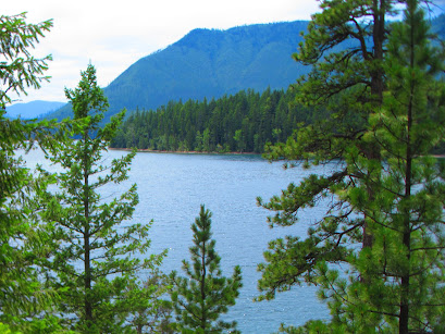
I stood there in awe ... just trying to take it all in. As we walked from our campsite to the shoreline of Lake McDonald, the endless beauty of Glacier National Park lie before us.
Patches of snow still on the mountains ...
Deep blue water flowing on for miles ...
Cascading hillsides of green pine trees ...
From near our campsite at Fish Creek, I was getting my first glimpse of Glacier National Park.
Doug was first captivated by Glacier's beauty nine years ago when he did a bike tour around the park with a few of his biking buddies. From the moment he got back home, his only traveling ''bucket list'' item was to take me there for more camping and hiking. Earlier this year, we decided that Glacier would be our main travel destination for this summer. With the arrival of Covid, however, we were a little unsure if this trip would be possible. The eastern border of Glacier lies next to the Blackfeet Indian Reservation, so entrances and services on that half of the park are currently closed due to the pandemic. Only one of the seven campgrounds in Glacier is open, limiting our options for camping in the park. But, as luck would have it, we were able to snag a spot for four nights in Glacier's Fish Creek Campground ... And so, we got ready for a ...


Glimpse of Glacier National Park!

When we arrived at the park, we quickly settled into our campsite and scoped out the area around us. We started on the trail near our campsite that led us along the shore of Lake McDonald. I got a little nervous when the path took us farther into the woods since we had no bear spray, and I was sure that Doug would be able to out run me if necessary! Doug just rolled his eyes slightly as we turned back, and probably muttered to himself how highly unlikely it would be that we would be lucky enough to even catch a glimpse of a grizzly.
Like many first time tourists, we were eager to see it all. Since Going to the Sun Road is the only road accessible for anyone visiting the park right now, it was the one we needed to take in order to access any of the open hiking trails. There is, however, a vehicle length restriction of 21 feet for this road which is exactly what the Baby Beest measures. We had our fingers crossed that the park rangers wouldn't stop us for being too long because ... We were ''Going to the Sun''!

If that deer isn't concerned
about the steep drop off at the
side of road, Baby Beest isn't
going to be concerned either!

The Going to the Sun Road starts out fairly flat as it runs along the Lake McDonald shoreline. The Avalanche Creek area is the point at which the road starts its famous twists and turns and begins to gain some serious elevation. I am happy to say that we made it up to Logan Pass which is the location of the Highline Trailhead, the one trail that Doug had his heart set on hiking.


But alas, we found out once we got there that we are going to have to settle for a glimpse of the Highline Trail. In late July it was still closed to hiking since there was still snow on the trail. I suppose that I should be disappointed, but when Doug pointed out that the trail runs alongside the mountain ridge on the right side of this picture below, I was secretly happy to save that RVenture for another time!


We did try our snow climbing skills on the Hidden Lake Overlook trail that starts out behind the Logan Pass Visitor Center. This was challenging enough for me, so I am glad that I didn't have to use these snow climbing skills on a higher, narrower trail like the Highline. There were also a lot of people out on this wide trail, so we are both thinking that social distancing would get to be a bit more difficult as the trail narrows.
On the way back down, we found a scenic parking spot on the side of the road. 


I will cook dinner any time when the view out of my kitchen window looks like this!


We watched the sun disappear behind a distant mountaintops and quickly started back down in order to stay well ahead of the hundreds of other sunset spectators. 


While it is only 32 miles from our campground to Logan's Pass, it took us almost an hour and fifteen minutes to make the trip each way. Since our hiking options were somewhat limited up there with the snow and road closures, we decided to get a glimpse of the trails closer to our campsite.

Howe Lake Trail
Getting there is half the fun! We were told to ''just follow this gravel road up about six miles to the trailhead'' ... the ranger forgot to add the fact that this road was a bit rough, steep, narrow and twisty at times! Doug kept Baby Beest on the road while I prayed that we wouldn't meet another big vehicle like ours going the opposite direction.


Once we got there, it was a delightful 1.6 miles hike through a forest of wildflowers to a serene mountain lake.


 Rocky Point Trail
Our favorite ''let's take a hike'' hike. We started out from our campsite and followed a loop through the forest and out to Rocky Point. On the way back the trail followed the lakeshore back to the camping area. Gorgeous lake and mountain views everywhere we looked!


McDonald Creek Trail
In order to find a parking spot, it is best to plan to arrive at the trailheads either early in the morning or around supper time. So one morning we decided to get up with the sun, drive to the trail head parking area, and enjoy our coffee overlooking McDonald Creek. We then hiked along the river and through beautiful pine forests until we got to the waterfall at the end of the trail. Doug was unsuccessful in his search for moose that we were told frequented this area, but it was nice to have a beautiful 8+ mile hike done and be back lounging in our hammock by 11 am.


Avalanche Lake Trail
This is a very popular trail, and even more so this year with so much of the park closed off. I knew that I would be pushing my luck to get Doug up early two days in a row, so we tried the late evening time frame for this hike. We arrived at the trail head around 5 pm and luckily snagged a spot that didn't leave Baby Beest's back end hanging out in the road. After eating dinner (during which time the area seemed to empty out more), we started our 2.3 mile out and back hike. There still were plenty of people on the trail, but for the most part, the trail was wide, so we didn't have to don our lovely masks very often. The path started out along a massive river gorge and led us through a pine forest where the evidence of avalanches dragging down huge pine trees was definitely visible.


There were rumors of a bear sighting as we approached the lake, but we were OK to have missed him and just enjoy the sheer beauty of Avalanche Lake and its distant waterfalls. 


During our four days there, we experienced just a glimpse of Glacier National Park. But that is alright. A place as beautiful as Glacier is best enjoyed in small doses of ...

... wildflowers overlooking a mountain lake,

... pine trees towering above,

... wildflowers carpeting the
mountainsides,
... curious friends greeting us,

... and wild huckleberries just begging
to be picked.


Glacier National Park is a place so magical, that even
this small glimpse
has created memories that will be forever etched in our hearts.