-->

Wednesday, August 24, 2022

Wrangell-St Elias National Park: The Historical and Natural Beauty of USA's Largest National Park

It's no surprise that the largest state in the United States is also home to the largest national park ... Wrangell-St Elias National Park. Along with Denali and Kenai Fjords, Wrangell-St Elias is the other national park in Alaska that is accessible by automobile. Boat or plane needed in order to visit the other five. And, as we soon found out, while the roads leading into the park can be a bit challenging, the history and natural beauty that awaits inside the park is worth the journey.


We caught a small glimpse of the 13.2 million acres that make up Wrangell-St Elias National Park when we were on our way down to Valdez. It is often called ''The Mountain Kingdom of North America'' because nine of the sixteen highest mountain peaks in the US are located in this national park ... including Mount St Elias, the second highest mountain in the United States. And because this national park borders Glacier Bay National Park as well as two Canadian national parks, the combined 24 million acres makes up the largest transboundary protected area in the world.


Mount Wrangell, an active volcano, and rows of other snow-capped beauties arose to greet us as we drove along the Richardson Highway towards Valdez. We stopped to find out more about this national park at the Copper Center Visitor Center, located alongside this highway. There we learned that in addition to being home to massive mountain peaks, glaciers, and ice fields, Wrangell-St Elias also has an interesting historical side. Those brave (or crazy) enough to travel down the McCarthy Road, will be rewarded with chance to visit the well-preserved remnants of an early 20th century copper mining community.

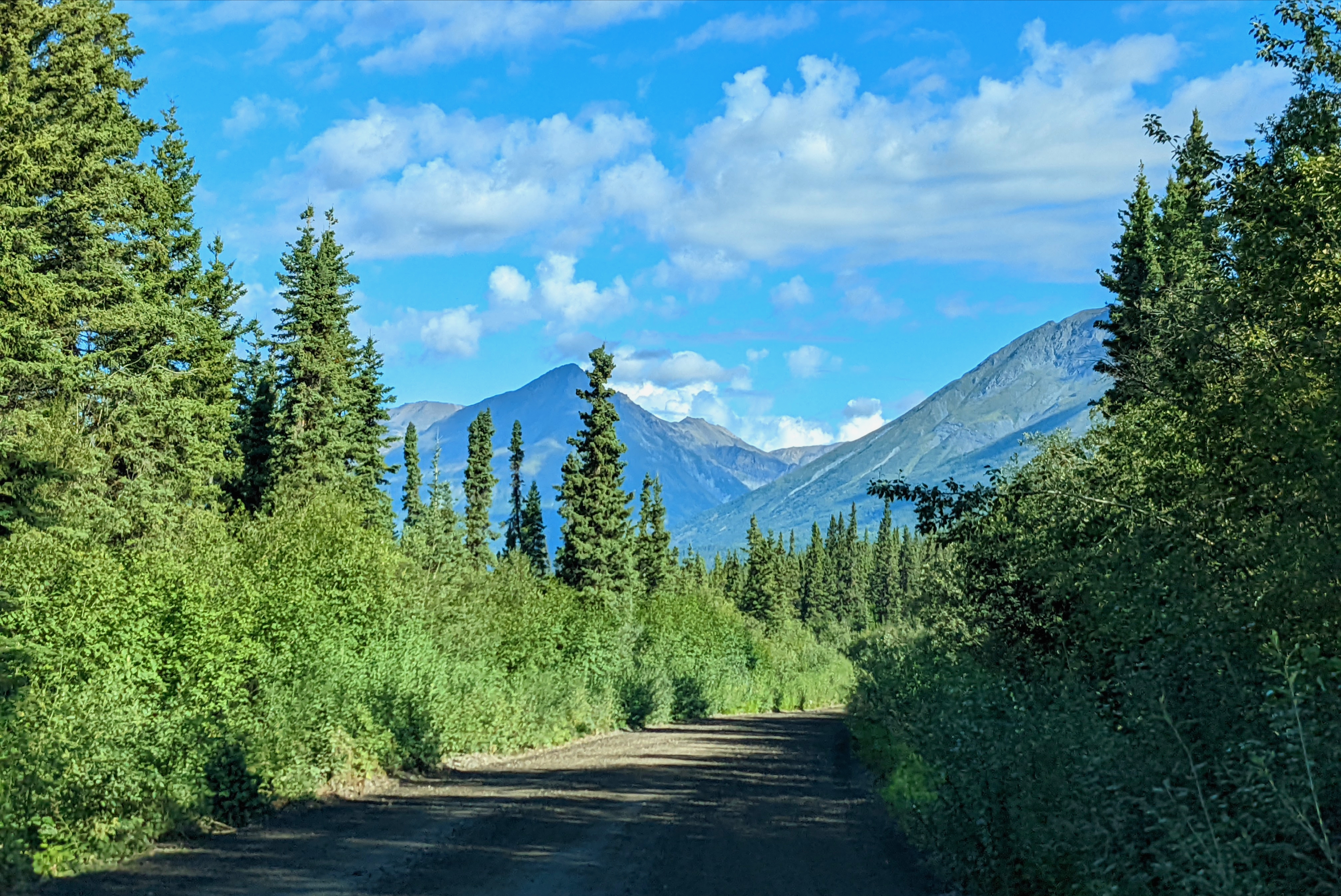
 How bad can this narrow, twisty, gravel road be??

Not bad at all as long as we take it slow, and our tires don't happen to find any railroad spikes leftover from the days when this 62 mile road served as the train route from the copper mines to the shipping port 200 miles away.

Bridges over river gorges provided beautiful scenery for us,


... but we could only imagine how the harsh Alaskan weather and terrain would have made it a challenge for the early prospectors to reach their destination, the mountains near Kennicott Glacier.


Yes, as early explorers discovered, the green layer of stone was actually an abundant supply of valuable copper embedded in the limestone of those mountains!


Backed by some wealthy investors, Kennecott Copper Corporation mined one of the world's richest sources of copper beginning in 1907. The area exploded with activity as fortunes were quickly made. But just as quickly, the demand and price of copper fell, and the mines and towns were abandoned in 1938. Fortunately, the buildings held up fairly well over time and today are being preserved in Wrangell-St Elias National Park as the Kennecott Mines National Historic Landmark.


Many of the buildings have been restored for the public to view.


Others, like the 17-story concentration mill are open only through private tours. I wanted to learn more about the history of this town in the middle of nowhere, so for a $28 admission, we got to see and hear ''the rest of the story.'' 


Our guide, Gabe, entertained us for two hours with the history of the town as well as the mechanics of the mines and concentration mill. He explained how the crushing, leaching and floatation devices worked to extract 98% of the copper embedded in the surrounding rock.

Historical  and engineering discussions
were enjoyed by all!

The copper was then transported in pure form via the Copper River & Northwestern (CR&NW) railroad 200 miles south to the seaport at Cordova, Alaska. It was then shipped to Tacoma, Washington where it was further processed and sold as important metal that was in demand in the expanding building and automobile industries. During the 31 years of operation, the owners made around $100 million in profit ... which translates to about $3 billion in today's dollars.


With so much profit to be made, the mine's owners spared no expense in making sure that they could get the copper to market. The CR&NW rail line that transported the copper through the harsh Alaskan wilderness was completed in just four years time. It was still, however, jokingly referred to as the ''Can't Run & Never Will'' railroad because of all the challenges it faced operating  year-round in the cold, snowy Alaskan wilderness.


During these peak production years, the area around the Kennecott Mines became boom towns. 600 men, mostly immigrants, worked in the harsh conditions of the mill and nearby mines. The mines operated 24 hours a day, 7  days a week, 363 days a year ... no work on 4th of July and Christmas! Services like a state-of-the-art hospital, school, recreation hall, stores, and bunk houses supported the company and its employees.


Five miles down the road, the town of McCarthy sprang up and provided the ''fun'' aspects of life for the miners in the form of diners, theaters, and saloons.


Today much of the town of McCarthy has also been restored and serves as the tourism hub for the area. The town's buildings remind visitors of this area's historical past.


While the history of this area abounds, it is the surrounding beauty of Wrangell-St Elias National Park that truly rewards you for venturing the 62 miles on the challenging McCarthy Road.


The Root Glacier Trail led us from the Kennecott Mill along a rocky path left by the retreating glacier. If we would have had crampons, we could have joined the other hikers walking on the glacier. But after seeing the downhill (and then uphill) climb, we were happy to just enjoy our view from the trail,


... and later from our campsite.


Although the roads are challenging and access is limited, a visit to Wrangell-St Elias National Park is filled with enormous rewards in the form of historical and natural beauty.


Wednesday, August 17, 2022

The Kenai Peninsula: Alaska's ''Mini-Me''


Alaska is immense in size ... and equally immense in landscapes, wildlife, and scenery. While studying the map of this largest state in the United States, I remember feeling a bit intimidated. Would two and a half months be enough time to see everything that we wanted to see? How do people best experience ''all things Alaskan'' in less time than that? My answer came when we spent two and a half weeks in the Kenai Peninsula, which is located an hour south of Anchorage. With its coastal fishing towns, mountain and glacial views, salmon-filled streams, and aqua-blue inland lakes, the Kenai Peninsula is truly Alaska's ''mini-me''.

As we drove along Turnagain Arm, we soon realized why Alaska's Kenai Peninsula is a popular destination for visitors who have a shorter time frame but still want to experience all the beauty of interior Alaska. Located directly south of Anchorage, the peninsula is surrounded by the waters of Cook Inlet, Turnagain Arm, Gulf of Alaska, and Prince Edward Sound.

Active volcanoes, mountains, and glaciers can be seen in the distance.

Bears and moose hang out in the many lakes and streams.

Fishing enthusiasts reel in super-sized halibut, salmon, and trout.


Hiking trails lead to amazing vistas.

Measuring only 200 miles long and 100 miles wide, the Kenai Peninsula can easily be explored in a week or two. Here are some of our suggestions for places in the Kenai that can add ''maximum'' beauty to a ''mini'' Alaskan adventure.


The Alaska Wildlife Conservation Center.

This non-profit sanctuary cares for injured animals and promotes research and education to maintain the health of Alaska's precious wildlife population. During our walk around the center's grounds, we were able to see moose, caribou, eagles, and muskox up close, but the elusive grizzlies didn't make an appearance.


Russian River Trail

Fishermen and bears alike joyfully await the summer return of spawning salmon to the area's many rivers and streams. We enjoyed watching the action from a path alongside the river, but the serene hike got a little more action-packed when one of the bears decided to head down the same narrow path that we were on. Stay calm and keep the bear spray handy!


Captain Cook State Recreation Area

Located at the end of the road in the northwestern corner of the peninsula, this state park has a quiet campground that overlooks Cook Inlet. Mama and Baby Moose visited our campsite as they enjoyed their healthy breakfast of greens. Beautiful walks along the rocky beach revealed numerous nesting shore birds, fields of wildflowers, interesting rock formations, and magestic mountains in the distance.


Homer

Homer, Alaska, located on the southwest edge of the peninsula, is known as the ''Halibut Fishing Capital of the World''. Lake Clark and Katmai National Parks, well-known for their bear viewing opportunities, are just a short, but expensive, flightseeing plane ride away. Since I had gotten as close as I wanted to get to grizzlies when visiting Russian River, we decided to save that experience for another time. Walking along the Homer Spit harbor area, feasting on halibut tacos, savoring the fragrance of the gigantic blooming peonies, and meeting up with a passionate fisherman buddy of Doug's was plenty fun for us.


Hidden Lake Campground

We got off the main highway and found a serene inland lake where some traveling buddies of ours are serving as camp hosts. Bill and Linda proudly showed us around their ''little piece of heaven'' and accompanied us on one of their favorite hiking trails. And yes, three out of four people agree that the fashionable mosquito netting is the way to go!


Hope

A 17-mile detour brought us to the shore of Turnagain Arm where the remnants of a tiny gold-rush town still remain. The sleepy village of Hope was once a bustling town of over 3000 ''hopeful'' prospectors. We found our treasure at a beautiful boondocking spot overlooking the water. Peaceful, out-of-the-way resting spots like this are what makes our Alaskan travels ''golden''... even during the occasional rainy and foggy day.


Seward

Gateway to Kenai Fjords National Park, the town of Seward captures all aspects of ''typical'' Alaskan scenery. Glaciers, mountains, wildlife, rainforests, fjords, and seaside marinas come together to make a visit to Seward truly magical.


Whittier

Whittier was founded as a strategic port location for the US military during WWII when in 1943 it was connected to the mainland of Alaska via a 2.5 mile train tunnel cut through Maynard Mountain. Today the tunnel allows both cars and the train (each taking turns) to access the tiny and picturesque community located on the edge of Prince William Sound. Unfortunately, the local saying, ''it's always sh***ier in Whittier'' proved true when we visited as heavy rain and fog obscured the view from what could have been a primo boondocking site and turned the trails to mud. But it also allowed me to visit the local museum which highlighted Alaska's experiences during WWII ... Did you know that the Japanese occupied Attu, a tiny Aleutian island that is the westernmost point of the US, from June of 1942 through May of 1943? Attu Island was also the site of the only US land battle during that war. The things I learn on a rainy day.


Portage Glacier

Portage Lake, formed by the melting of nearby Portage Glacier, lies on the other side of the tunnel to Whittier. And true to form, the rain stopped and the sun peeked out when we got to that other side. Once there, we decided to take the hour-long Portage Glacier Cruise to see the face of another glacier. Never tire of that beauty! Afterwards, a short, flat one-mile hike brought us to Byron Glacier. It is relatively small compared to other glaciers, but the chance to be ''up close and personal'' with any type of glacier is still pretty special.


Forests, mountains, glaciers, wildlife, and views galore. You don't have to drive for thousands of miles to experience the quintessential Alaskan adventures.

They await you in the Kenai Peninsula ... Alaska's ''mini-me''!