Minneapolis has consistently ranked high as a "Bike Friendly" city. It certainly can boast of miles of beautiful bike trails, many of which we have enjoyed since arriving at Baker Park Reserve.

We have been intrigued with the idea of trying to bike from the campground to downtown Minneapolis completely on these bike trails. This past week we had a good opportunity to attempt this, since biking conditions were going to be perfect ... high temps, low humidity, no wind! Since we are done with our evening camp host responsibilities, we had plenty of daylight in order to attempt an epic long ride. Doug had figured a ride to downtown Minneapolis to be about 25 miles, so the crazy plan was proposed ... to add on a few more miles and make it a metric century ride. On our slower folding bikes, Chris was sure that this 63 miles was really going to feel like 100! Setting out from the campground at about 10am would give us a good eleven hours to accomplish this feat while allowing plenty of time to take advantage of a variety of refueling stops.

Almost ready to ride ... Chris packed some snacks just in case the food stops didn't come soon enough! The start of the trail is right behind the traffic cone across the road from our campsite.
We headed out on the trail that runs through the Baker Park Reserve. Views of marsh and forest make it a beautiful start to our ride. Cardinals greeted us with their magnificent colors and songs.
Halfway around the reserve loop we jog off to a short road past a private home before we reconnect with the trail. This is the only "road" that we will have to ride on until we hit downtown Minneapolis.
 |
| The short road section - maybe 1/4 mile |
 |
| Taking a left back onto the trail - still in Baker Park |
About 5 miles down the path, we were out of Baker Park and traveling through the town of Orono. We spy the first of many water towers that we will see on our journey today.
Biking past the Orono school district buildings and some beautiful homes, the Baker Park connector trails ends, and we hop on the Luce Line Trail. The great debate is the pronunciation of "Luce" ... "Loos" or "Loo-see" or "Loo-chey"??
Pictured is the beginning of our segment of the Luce Line trail as we headed east into Minneapolis. The trail also extends westward for many more miles, but we will save that RVenture for another day! This section of the trail is crushed limestone rather than asphalt ... a little more challenging, but the wide tires on our bikes seem to like it!
Strong wind storms moved through the area the previous evening ... yes, even the Wildebeest swayed a little in the wind. While the storm's front eliminated the humidity, it left behind quite a bit of debris. Obstacles such as branches, leaves, and downed limbs turned this section into an Olympic event. We became weightlifters at times when we were forced to lift our bikes over the downed branches.
 |
| The bridge over Highway 12/394 |
We came to the first of many bridges that would get us over, and tunnels that would lead us under the major highways. It is always a nice feeling to pedal past the metro traffic that was often at a standstill due to Minnesota's current road construction season.
A train happened to be going under our bridge ... a nice reminder that we have so many of these wonderful bike trails because of the many "rails to trails" programs.
The obstacles were getting more challenging, and we were starting to think that finding another trail for the return trip would be a good idea!
 |
| Flowers by the golf course in Wayzata, MN |
The ever-changing scenery is what makes a journey like this so spectacular. Whether it was flowers by a golf course, sail boats on a lake, or cute babies in jogging strollers ... there is always beautiful scenery to take our minds off our achy muscles or sore tush.
 |
| One of the many serene lakes that we passed by |
 |
| In Plymouth, MN - we transition from a gravel trail to paved. |
A good sign that we are getting closer to Minneapolis ... the trail transitioned from gravel to pavement as we entered the suburb of Plymouth. And our average speed sky-rocketed from 9 MPH to almost 11!
 |
| A long boardwalk allowed us to bike over a marsh area in Plymouth. |
Getting into the more populated areas, it was time to pay closer attention to Doug's GPS and the directional signs that line the trails. We wanted to make sure that we stayed on the Luce Line into Minneapolis rather than taking an extra loop around Medicine Lake ... already did that tour!
Whoo-Hoo! In Golden Valley, we catch our first view of the Minneapolis skyline.
 |
| The Golden Valley "Spaceship" |
According to the GPS and trail maps we should have been able to stay on the Luce Line right into Minneapolis, but what fun would it be if we didn't get a little lost and add a few more miles to our trip??!!
Not all those who wander are lost.
We somehow ended up on the Cedar Lake trail ... Yeah! This familiar trail has separate paths for bikers and walkers, and leads right into downtown Minneapolis.
At certain points, the bike lanes actually separate ... like a divided highway for bikes!
You can see the westbound bike trail and pedestrian trail on the left and right. We are on the eastbound bike trail ...
... approaching Minneapolis!
 |
| Approaching the Minnesota Twins Stadium |
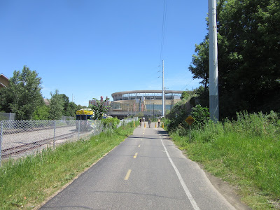
The trail leads us right to the Minnesota Twins stadium. We arrive at about 12:30 pm and can hear the crowds roaring. If we planned this better, we could have taken in a baseball game ... OK, probably not enough daylight for that.
Just before reaching the stadium, we exit the trail and take the connector trail down a "bike friendly" road into downtown. A "bike friendly" road may typically have a wider right lane, speed bumps to slow car traffic, and signs indicating that it is a prefered route for bikes. That being said, bicyclists should always be aware of car traffic even on "bike friendly" roads.
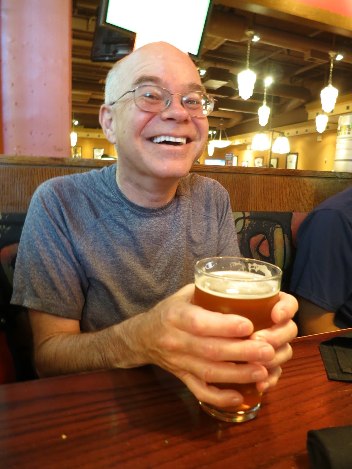
At some points we do a bit of sidewalk as well as bike lane biking. Our MPH average is about to go down as we walk our bikes along some of the busier sections of sidewalk. But our efforts are worth it, we have arrived at our first "refueling" station, Rock Bottom.
 |
| Picture taken in 2015, but the emotion is still the same! |
We had a great lunch, but now we need to figure out how we will get back "home" again! We didn't really want to do the same route back, since that would be boring, plus there were all those fallen trees that we would have to deal with again. We decided we would go back to the Twins stadium and take the Metro Transit light-rail south to Minnehaha Falls and pick up the trails down there. We could have biked the six miles along the Mississippi River trail, but decided that riding the train would ensure that we would see some more great sights and still get home before dark!
 |
| Biking around the stadium |
 |
| Pitch it in there, Charlie Brown! |
Charles Schulz was born and grew up in the Twin Cities (Minneapolis and St Paul), so statues of his characters populate the grounds around the Twins stadium.
 |
| Snoopy! |
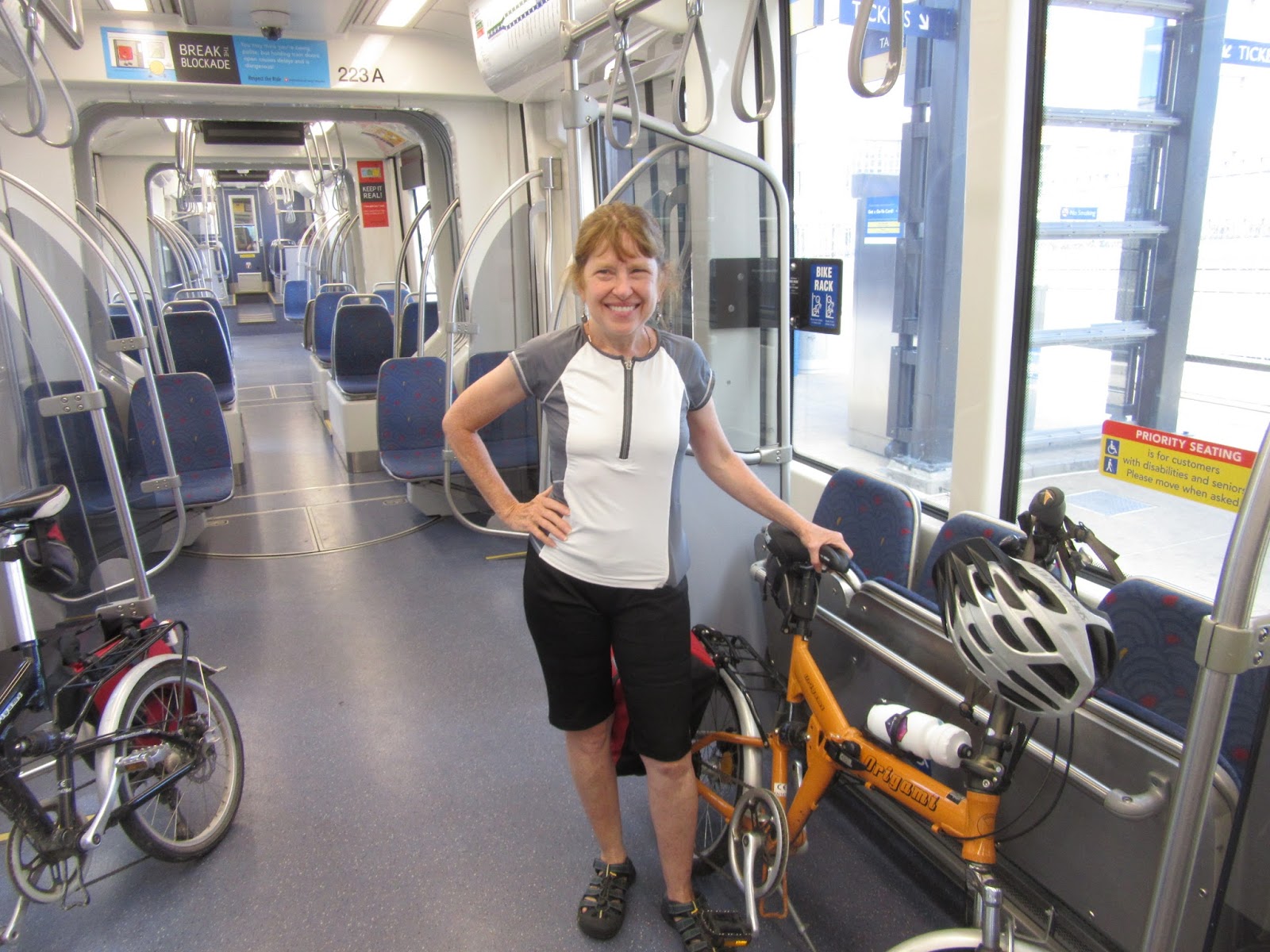
We bought our tickets and caught the light-rail right by the Twins stadium.
 |
| Getting on the Blue Line to take us south. |
 |
| The nearly empty cars had plenty of room for our bikes. |
We got our bikes easily on the light rail and enjoyed the chance to relax as the miles still accumulated on Doug's GPS.
 |
| 2 tickets - $3.50 good for a few hours of riding the train. |
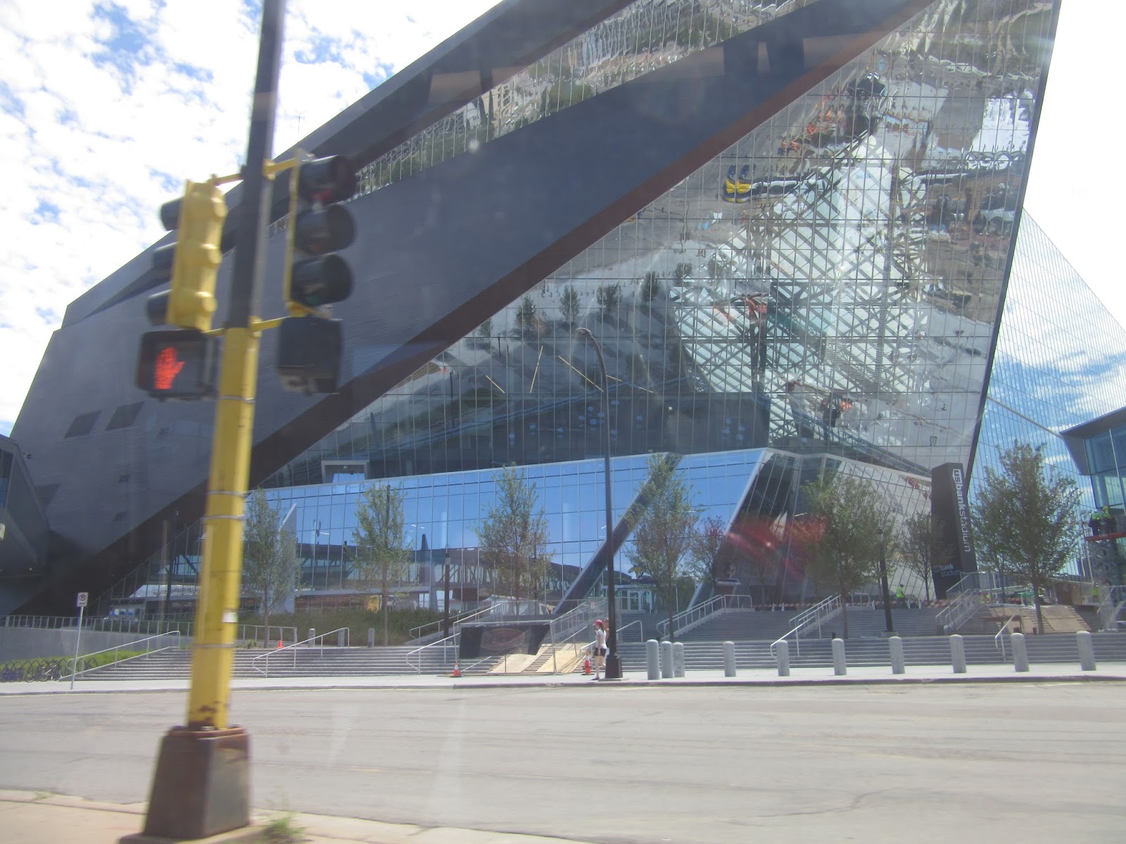
The train passed by US Bank Stadium, the new home for the Minnesota Vikings. The public "open house" is scheduled for the weekend of July 23 with sporting events starting shortly after. It is quite an impressive engineering feat and will be a great location for the 2018 Super Bowl ... as long as Mother Nature plays nicely and keeps the blizzards away!
 |
| Biking the Minnehaha Creek Trail westward. |
All relaxing forms of travel eventually come to an end. We got off at the 46th Street station and easily connected with the Minnehaha Creek trail. This trail follows the lovely shaded creek past beautiful houses and neighborhoods until it connects with the lakes in south Minneapolis
Through this section, Doug really did not need his GPS. We have meandered on this trails many times as Chris grew up and still has family nearby.
We came to the first of a chain of lakes, Lake Harriet. While there were not the massive weekend crowds, there were still many people enjoying a perfect summer afternoon at the beach.
Minneapolis has a unique gift reflected in its city parks. In the late 1800s, local government officials decided to designate all land around the many lakes, streams, and rivers as park land. So, when you are biking in these areas you can see and enjoy the natural features rather than the backs of houses on shoreline property. We appreciate that this makes Minneapolis a very welcoming and scenic community for everyone ... not just for those that can afford the lakefront property. It is a great gift, contributing to the beauty and quality of life in Minneapolis. You can read about the history here: https://www.minneapolisparks.org/about_us/history/
 |
| Continuing around Lake Harriet. Great views of the lake! |
Along with being very familiar with the trails in this area, we are also well-versed on where to get the best ice cream of all time ... Sebastian Joe's!

Our favorite flavor is "the Flavor Formally Known as Nicollet Pothole." Chocolate, caramel, Heath bar chunks, fudge truffles, and a fudge swirl with sea salt ... need we say more?? We are fueled up for more miles!
After Sebastian Joe's, we took a shortcut to Lake Calhoun. Lovely to see the Minneapolis skyline from another vantage point.
Once we got half way around Lake Calhoun, we connected with the Midtown Greenway trail and headed west towards St. Louis Park. Our eventual goal was LTD Brewery in Hopkins. However, Steel Toe Brewing, four miles from Lake Calhoun was calling Doug's name. We declared the barrel aged "Wee Heavy" really good.
 |
| Steel Toe Brewery |
 |
| Two beauties: Barrel aged "Wee Heavy" and Chris |
A looonnng train delayed our ability to get back on the trail after Steel Toe, but that just reaffirmed that another hydration stop was needed. Once we got to Hopkins, we stopped at LTD Brewery. At this point, Chris is definitely feeling the need for SUGAR, so she opted for the locally brewed Root Beer ... and free popcorn was a great bonus!
 |
| LTD ... Live The Dream! |
 |
| LTD's beer list .... tough decisions! |
When we finished there, we had a tough decision to make. We could take the short route back to Baker Park through Wayzata (about 15 miles), or take a longer route through Excelsior (about 25 miles). With the root beer and popcorn doing their job, Chris was feeling re-energized and let Doug make the decision. Of course, he opted for the longer route, which would give us an additional dinner, brewery and ice cream stop ... sounds like a win-win-win situation to us!
 |
| The trail to excelsior was gravel (again). No fallen tree debris though! |
Another beautiful trail lead us out of Hopkins and over the rush-hour packed highways. The only bummer was that the trail became crushed rock again, and at this point, we were not super-thrilled about putting in the extra effort that is needed to bike on gravel.
 |
| Another town water tower ... how many does that make for the day? |
 |
| The outside of the brewery. |
Because the brewery does not serve food, we picked up a sandwich at a local convenience store and headed to Doug's "bonus" brewery ... Excelsior Brewing. We enjoyed a "so-so" sandwich and one of their seasonal beers, Sunburn Cherry Wheat ...

... and relaxed with great live music from some very talented guitarists!
Unfortunately, too much relaxing is not a good thing, especially when we have about 13 miles to go in order to get back to Baker Park. Yup, we were both feeling the effects of the heat and all the miles. A pit stop for ice cream at the Culver's along the route was a definite must.
And other bikers had the same idea. The Culver's bike parking lot was full so we just leaned our bikes against the wall. We think that they enjoyed their together time also!
Pumped full of jet-fuel quality frozen custard, we tackled the last nine miles. Chris' bike odometer and our camera battery went dead at that point ... we think they also had enough of this RVenture for the day. It now became a race against the sun to get back to the park before dark. We made it, arriving back "home" 10.5 hours after we left. We both were very tired but felt accomplished with our 67 miles of biking. We achieved our goal to do a metric century while enjoying Minneapolis' bike trails "there and back".
Here is the complete route that we did (including the train segment from mile 28 to 34): https://ridewithgps.com/trips/9827243
Until next time ... explore fun places ... and enjoy the adventures in your life!
Print this post


 Along with being very familiar with the trails in this area, we are also well-versed on where to get the best ice cream of all time ... Sebastian Joe's!


Wow! This was an epic journey! Look at that map! Thanks for taking me along!
ReplyDeleteLots of biking for a day ... and a lot harder on our slow, comfy bikes, But great trails and sights!
Delete